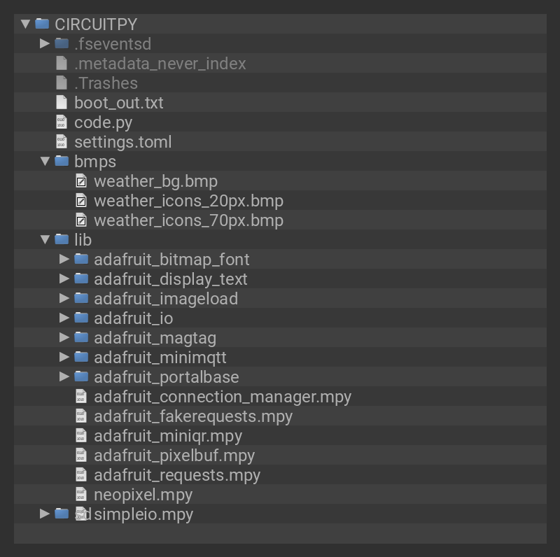
Here is the project code along with some additional setup needed.
Weather Icons
The icons used in this project were inspired by this other EPD based weather project - eInk / ePaper Weather Station. They are the excellent set of Meteocons , which the author has made freely available. For this project, we converted them to gray scale, scaled them as needed, and converted to bitmap.
Open Weather Maps API Key
We'll be using OpenWeatherMap.org to retrieve the weather info through its API. In order to do so, you'll need to register for an account and get your API key.
Go to this link and register for a free account. Once registered, you'll get an email containing your API key, also known as the "openweather token".
Copy and paste this key into your secrets.py file that is on the root level of your CIRCUITPY drive. Name the entry openweather_token, ex:
'openweather_token' : 'my_openweather_token',
It'll look something like this
'openweather_token' : 'b218dde228d7be12f16bf4640208b9f5',
this is not a valid token, you have to get your own!
Set Location
We will also use secrets.py to set your location. To do so, add new entry called openweather_location and specify either your city name and country code:
'openweather_location' : 'Thief River Falls, US',
or by using a two tuple of latitude and longitude:
'openweather_location' : (47.6062, -122.3321),
Note that negative longitude values are use for West.
You can verify your town or city is valid by visiting https://openweathermap.org/find and typing it into the box, if you get a weather report, then that's a known city! However, if you run into a situation where the city name is ambiguous (multiple same name cities), then use the latitude/longitude value to specify location.
Celsius or Fahrenheit
The units used for the temperature readings can be set to either Celsius or Fahrenheit. The units are set to Fahrenheit by default. To change to Celsius, look for this line of code:
METRIC = False # set to True for metric units
and change it to:
METRIC = True # set to True for metric units
In addition to changing temperature readings to Celsius, this will also change the wind readings to meters per second.
Secrets Summary
Your resulting secrets.py file should looking something like the example below, but with your specific values. It's OK if there are more entries - for other services, etc. But you need at least the ones shown here.
secrets = {
    'ssid' : 'myssid',
    'password' : 'mypassword',
    'openweather_token' : 'my_openweather_token',
    'openweather_location' : 'Thief River Falls, US',
}
To use with CircuitPython, you need to first install a few libraries, into the lib folder on your CIRCUITPY drive. Then you need to update code.py with the code listing below.
Thankfully, we can do this in one go. In the example below, click the Download Project Bundle button below to download the necessary libraries and the code.py file in a zip file. Extract the contents of the zip file, open the directory MagTag_Weather/ and then click on the directory that matches the version of CircuitPython you're using and copy the contents of that directory to your CIRCUITPY drive.
Note that there are two versions of the code located in subfolders:
- onecall - Requires non-free account/API key.
- forecast - Works with free account/API key.
See the code specific sections below for more detail. Only one version should be used at a time.
One Call API (non free)
This is the original version of the code, written when access to the One Call API was available with a free API key. The One Call API now requires the API key be associated with an Openweathermap account that's been set up for payments.
Older account/API keys may still work. For any new accounts/API keys that want a free version, the Forecast API version of the code below will likely be needed.

# SPDX-FileCopyrightText: 2020 Carter Nelson for Adafruit Industries
#
# SPDX-License-Identifier: MIT
# pylint: disable=redefined-outer-name, eval-used, wrong-import-order

import time
import terminalio
import displayio
import adafruit_imageload
from adafruit_display_text import label
from adafruit_magtag.magtag import MagTag
from secrets import secrets

# --| USER CONFIG |--------------------------
METRIC = False  # set to True for metric units
# -------------------------------------------

# ----------------------------
# Define various assets
# ----------------------------
BACKGROUND_BMP = "/bmps/weather_bg.bmp"
ICONS_LARGE_FILE = "/bmps/weather_icons_70px.bmp"
ICONS_SMALL_FILE = "/bmps/weather_icons_20px.bmp"
ICON_MAP = ("01", "02", "03", "04", "09", "10", "11", "13", "50")
DAYS = ("Monday", "Tuesday", "Wednesday", "Thursday", "Friday", "Saturday", "Sunday")
MONTHS = (
    "January",
    "February",
    "March",
    "April",
    "May",
    "June",
    "July",
    "August",
    "September",
    "October",
    "November",
    "December",
)
magtag = MagTag()

# ----------------------------
# Backgrounnd bitmap
# ----------------------------
magtag.graphics.set_background(BACKGROUND_BMP)

# ----------------------------
# Weather icons sprite sheet
# ----------------------------
icons_large_bmp, icons_large_pal = adafruit_imageload.load(ICONS_LARGE_FILE)
icons_small_bmp, icons_small_pal = adafruit_imageload.load(ICONS_SMALL_FILE)

# /////////////////////////////////////////////////////////////////////////


def get_data_source_url(api="onecall", location=None):
    """Build and return the URL for the OpenWeather API."""
    if api.upper() == "GEO":
        URL = "https://api.openweathermap.org/geo/1.0/direct?q="
        URL += location
    elif api.upper() == "GEOREV":
        URL = "https://api.openweathermap.org/geo/1.0/reverse?limit=1"
        URL += "&lat={}".format(location[0])
        URL += "&lon={}".format(location[1])
    elif api.upper() == "ONECALL":
        URL = "https://api.openweathermap.org/data/2.5/onecall?exclude=minutely,hourly,alerts"
        URL += "&lat={}".format(location[0])
        URL += "&lon={}".format(location[1])
    else:
        raise ValueError("Unknown API type: " + api)
    return URL + "&appid=" + secrets["openweather_token"]


def get_latlon(city_name):
    """Use the Geolocation API to determine lat/lon for given city."""
    magtag.url = get_data_source_url(api="geo", location=city_name)
    raw_data = eval(magtag.fetch())[0]
    return raw_data["lat"], raw_data["lon"]


def get_city(latlon_location):
    """Use the Geolocation API to determine city for given lat/lon."""
    magtag.url = get_data_source_url(api="georev", location=latlon_location)
    raw_data = eval(magtag.fetch())[0]
    return raw_data["name"] + ", " + raw_data["country"]


def get_forecast(location):
    """Use OneCall API to fetch forecast and timezone data."""
    resp = magtag.network.fetch(get_data_source_url(api="onecall", location=location))
    json_data = resp.json()
    return json_data["daily"], json_data["current"]["dt"], json_data["timezone_offset"]


def make_banner(x=0, y=0):
    """Make a single future forecast info banner group."""
    day_of_week = label.Label(terminalio.FONT, text="DAY", color=0x000000)
    day_of_week.anchor_point = (0, 0.5)
    day_of_week.anchored_position = (0, 10)

    icon = displayio.TileGrid(
        icons_small_bmp,
        pixel_shader=icons_small_pal,
        x=25,
        y=0,
        width=1,
        height=1,
        tile_width=20,
        tile_height=20,
    )

    day_temp = label.Label(terminalio.FONT, text="+100F", color=0x000000)
    day_temp.anchor_point = (0, 0.5)
    day_temp.anchored_position = (50, 10)

    group = displayio.Group(x=x, y=y)
    group.append(day_of_week)
    group.append(icon)
    group.append(day_temp)

    return group


def temperature_text(tempK):
    if METRIC:
        return "{:3.0f}C".format(tempK - 273.15)
    else:
        return "{:3.0f}F".format(32.0 + 1.8 * (tempK - 273.15))


def wind_text(speedms):
    if METRIC:
        return "{:3.0f}m/s".format(speedms)
    else:
        return "{:3.0f}mph".format(2.23694 * speedms)


def update_banner(banner, data):
    """Update supplied forecast banner with supplied data."""
    banner[0].text = DAYS[time.localtime(data["dt"]).tm_wday][:3].upper()
    banner[1][0] = ICON_MAP.index(data["weather"][0]["icon"][:2])
    banner[2].text = temperature_text(data["temp"]["day"])


def update_today(data, tz_offset=0):
    """Update today info banner."""
    date = time.localtime(data["dt"])
    sunrise = time.localtime(data["sunrise"] + tz_offset)
    sunset = time.localtime(data["sunset"] + tz_offset)

    today_date.text = "{} {} {}, {}".format(
        DAYS[date.tm_wday].upper(),
        MONTHS[date.tm_mon - 1].upper(),
        date.tm_mday,
        date.tm_year,
    )
    today_icon[0] = ICON_MAP.index(data["weather"][0]["icon"][:2])
    today_morn_temp.text = temperature_text(data["temp"]["morn"])
    today_day_temp.text = temperature_text(data["temp"]["day"])
    today_night_temp.text = temperature_text(data["temp"]["night"])
    today_humidity.text = "{:3d}%".format(data["humidity"])
    today_wind.text = wind_text(data["wind_speed"])
    today_sunrise.text = "{:2d}:{:02d} AM".format(sunrise.tm_hour, sunrise.tm_min)
    today_sunset.text = "{:2d}:{:02d} PM".format(sunset.tm_hour - 12, sunset.tm_min)


def go_to_sleep(current_time):
    """Enter deep sleep for time needed."""
    # compute current time offset in seconds
    hour, minutes, seconds = time.localtime(current_time)[3:6]
    seconds_since_midnight = 60 * (hour * 60 + minutes) + seconds
    three_fifteen = (3 * 60 + 15) * 60
    # wake up 15 minutes after 3am
    seconds_to_sleep = (24 * 60 * 60 - seconds_since_midnight) + three_fifteen
    print(
        "Sleeping for {} hours, {} minutes".format(
            seconds_to_sleep // 3600, (seconds_to_sleep // 60) % 60
        )
    )
    magtag.exit_and_deep_sleep(seconds_to_sleep)


# ===========
# Location
# ===========
if isinstance(secrets["openweather_location"], str):
    # Get lat/lon using city name
    city = secrets["openweather_location"]
    print("Getting lat/lon for city:", city)
    latlon = get_latlon(city)
elif isinstance(secrets["openweather_location"], tuple):
    # Get city name using lat/lon
    latlon = secrets["openweather_location"]
    print("Getting city name for lat/lon:", latlon)
    city = get_city(latlon)
else:
    raise ValueError("Unknown location:", secrets["openweather_location"])

print("City =", city)
print("Lat/Lon = ", latlon)

# ===========
# U I
# ===========
today_date = label.Label(terminalio.FONT, text="?" * 30, color=0x000000)
today_date.anchor_point = (0, 0)
today_date.anchored_position = (15, 13)

city_name = label.Label(terminalio.FONT, text=city, color=0x000000)
city_name.anchor_point = (0, 0)
city_name.anchored_position = (15, 24)

today_icon = displayio.TileGrid(
    icons_large_bmp,
    pixel_shader=icons_small_pal,
    x=10,
    y=40,
    width=1,
    height=1,
    tile_width=70,
    tile_height=70,
)

today_morn_temp = label.Label(terminalio.FONT, text="+100F", color=0x000000)
today_morn_temp.anchor_point = (0.5, 0)
today_morn_temp.anchored_position = (118, 59)

today_day_temp = label.Label(terminalio.FONT, text="+100F", color=0x000000)
today_day_temp.anchor_point = (0.5, 0)
today_day_temp.anchored_position = (149, 59)

today_night_temp = label.Label(terminalio.FONT, text="+100F", color=0x000000)
today_night_temp.anchor_point = (0.5, 0)
today_night_temp.anchored_position = (180, 59)

today_humidity = label.Label(terminalio.FONT, text="100%", color=0x000000)
today_humidity.anchor_point = (0, 0.5)
today_humidity.anchored_position = (105, 95)

today_wind = label.Label(terminalio.FONT, text="99m/s", color=0x000000)
today_wind.anchor_point = (0, 0.5)
today_wind.anchored_position = (155, 95)

today_sunrise = label.Label(terminalio.FONT, text="12:12 PM", color=0x000000)
today_sunrise.anchor_point = (0, 0.5)
today_sunrise.anchored_position = (45, 117)

today_sunset = label.Label(terminalio.FONT, text="12:12 PM", color=0x000000)
today_sunset.anchor_point = (0, 0.5)
today_sunset.anchored_position = (130, 117)

today_banner = displayio.Group()
today_banner.append(today_date)
today_banner.append(city_name)
today_banner.append(today_icon)
today_banner.append(today_morn_temp)
today_banner.append(today_day_temp)
today_banner.append(today_night_temp)
today_banner.append(today_humidity)
today_banner.append(today_wind)
today_banner.append(today_sunrise)
today_banner.append(today_sunset)

future_banners = [
    make_banner(x=210, y=18),
    make_banner(x=210, y=39),
    make_banner(x=210, y=60),
    make_banner(x=210, y=81),
    make_banner(x=210, y=102),
]

magtag.splash.append(today_banner)
for future_banner in future_banners:
    magtag.splash.append(future_banner)

# ===========
#  M A I N
# ===========
print("Fetching forecast...")
forecast_data, utc_time, local_tz_offset = get_forecast(latlon)

print("Updating...")
update_today(forecast_data[0], local_tz_offset)
for day, forecast in enumerate(forecast_data[1:6]):
    update_banner(future_banners[day], forecast)

print("Refreshing...")
time.sleep(magtag.display.time_to_refresh + 1)
magtag.display.refresh()
time.sleep(magtag.display.time_to_refresh + 1)

print("Sleeping...")
go_to_sleep(utc_time + local_tz_offset)
#  entire code will run again after deep sleep cycle
#  similar to hitting the reset button
Forecast API (free)
This is a newer version of the code that uses the still free 5 Day / 3 Hour Forecast API. It attempts to provide the same informational display as the original version of the code. However, since there are some differences in the nature of the data returned by the two API's, there are some caveats.
- The forecast is for only four days, not five. That's because one of the "5 days" is the current day.
- Weather conditions forecasted for noon local time are used as "daily forecast".
# SPDX-FileCopyrightText: 2020 Carter Nelson for Adafruit Industries
#
# SPDX-License-Identifier: MIT
# pylint: disable=redefined-outer-name, eval-used, wrong-import-order

import time
import terminalio
import displayio
import adafruit_imageload
from adafruit_display_text import label
from adafruit_magtag.magtag import MagTag
from secrets import secrets

# --| USER CONFIG |--------------------------
METRIC = False  # set to True for metric units
# -------------------------------------------

# ----------------------------
# Define various assets
# ----------------------------
BACKGROUND_BMP = "/bmps/weather_bg.bmp"
ICONS_LARGE_FILE = "/bmps/weather_icons_70px.bmp"
ICONS_SMALL_FILE = "/bmps/weather_icons_20px.bmp"
ICON_MAP = ("01", "02", "03", "04", "09", "10", "11", "13", "50")
DAYS = ("Monday", "Tuesday", "Wednesday", "Thursday", "Friday", "Saturday", "Sunday")
MONTHS = (
    "January",
    "February",
    "March",
    "April",
    "May",
    "June",
    "July",
    "August",
    "September",
    "October",
    "November",
    "December",
)
magtag = MagTag()

# ----------------------------
# Backgrounnd bitmap
# ----------------------------
magtag.graphics.set_background(BACKGROUND_BMP)

# ----------------------------
# Weather icons sprite sheet
# ----------------------------
icons_large_bmp, icons_large_pal = adafruit_imageload.load(ICONS_LARGE_FILE)
icons_small_bmp, icons_small_pal = adafruit_imageload.load(ICONS_SMALL_FILE)

# /////////////////////////////////////////////////////////////////////////


def get_data_source_url(api="forecast", location=None):
    """Build and return the URL for the OpenWeather API."""
    if location is None:
        raise ValueError("Must specify location.")
    if api.upper() == "GEO":
        URL = "https://api.openweathermap.org/geo/1.0/direct?q="
        URL += location
    elif api.upper() == "GEOREV":
        URL = "https://api.openweathermap.org/geo/1.0/reverse?limit=1"
        URL += "&lat={}".format(location[0])
        URL += "&lon={}".format(location[1])
    elif api.upper() == "FORECAST":
        URL = "https://api.openweathermap.org/data/2.5/forecast?"
        URL += "&lat={}".format(location[0])
        URL += "&lon={}".format(location[1])
    elif api.upper() == "CURRENT":
        URL = "https://api.openweathermap.org/data/2.5/weather?"
        URL += "&lat={}".format(location[0])
        URL += "&lon={}".format(location[1])
    else:
        raise ValueError("Unknown API type: " + api)
    return URL + "&appid=" + secrets["openweather_token"]


def get_latlon(city_name):
    """Use the Geolocation API to determine lat/lon for given city."""
    magtag.url = get_data_source_url(api="geo", location=city_name)
    raw_data = eval(magtag.fetch())[0]
    return raw_data["lat"], raw_data["lon"]


def get_city(latlon_location):
    """Use the Geolocation API to determine city for given lat/lon."""
    magtag.url = get_data_source_url(api="georev", location=latlon_location)
    raw_data = eval(magtag.fetch())[0]
    return raw_data["name"] + ", " + raw_data["country"]


def get_approx_time(latlon_location):
    magtag.url = get_data_source_url(api="current", location=latlon_location)
    raw_data = eval(magtag.fetch())
    return raw_data["dt"] + raw_data["timezone"]


def get_forecast(location):
    """Use Forecast API to fetch weather data and return a "daily" forecast.
    NOTE: The data query is assumed to have been done at ~2AM local time so that
    the forecast data results are (also approx):
                0  3AM
                1  6AM
                2  9AM
                3 12PM
                4  3PM
                5  6PM
                6  9PM
                7 12AM
                :   :
                (etc.)
    """
    resp = magtag.network.fetch(get_data_source_url(api="forecast", location=location))
    json_data = resp.json()
    # build "daily" forecast data (similar to Onecall API)
    # it is assumed the first entry in the list is for ~3AM local
    # and the list is 40 entries at 3 hours intervals
    #     index  local_time
    #       0        3AM
    #       1        6AM
    #       2        9AM
    #       3       12PM
    #       4        3PM
    #       5        6PM
    #       6        9PM
    #       7       12AM
    #      etc.     etc.
    if json_data["cnt"] != 40:
        raise RuntimeError("Unexpected forecast response length.")
    timezone_offset = json_data["city"]["timezone"]
    daily_data = []
    # use the 12PM values from each day, access via direct indexing (slice)
    for data in json_data["list"][3::8]:
        daily_data.append(
            {
                "dt": data["dt"] + timezone_offset,
                "weather": data["weather"],
                "temp": {"day": data["main"]["temp"]},
            }
        )
    # add extra data for day 0 (current day)
    daily_data[0]["sunrise"] = json_data["city"]["sunrise"] + timezone_offset
    daily_data[0]["sunset"] = json_data["city"]["sunset"] + timezone_offset
    daily_data[0]["temp"] = {
        "morn": json_data["list"][2]["main"]["temp"],
        "day": json_data["list"][4]["main"]["temp"],
        "night": json_data["list"][6]["main"]["temp"],
    }
    daily_data[0]["humidity"] = json_data["list"][3]["main"]["humidity"]
    daily_data[0]["wind_speed"] = json_data["list"][3]["wind"]["speed"]

    return daily_data


def make_banner(x=0, y=0):
    """Make a single future forecast info banner group."""
    day_of_week = label.Label(terminalio.FONT, text="DAY", color=0x000000)
    day_of_week.anchor_point = (0, 0.5)
    day_of_week.anchored_position = (0, 10)

    icon = displayio.TileGrid(
        icons_small_bmp,
        pixel_shader=icons_small_pal,
        x=25,
        y=0,
        width=1,
        height=1,
        tile_width=20,
        tile_height=20,
    )

    day_temp = label.Label(terminalio.FONT, text="+100F", color=0x000000)
    day_temp.anchor_point = (0, 0.5)
    day_temp.anchored_position = (50, 10)

    group = displayio.Group(x=x, y=y)
    group.append(day_of_week)
    group.append(icon)
    group.append(day_temp)

    return group


def temperature_text(tempK):
    if METRIC:
        return "{:3.0f}C".format(tempK - 273.15)
    else:
        return "{:3.0f}F".format(32.0 + 1.8 * (tempK - 273.15))


def wind_text(speedms):
    if METRIC:
        return "{:3.0f}m/s".format(speedms)
    else:
        return "{:3.0f}mph".format(2.23694 * speedms)


def update_banner(banner, data):
    """Update supplied forecast banner with supplied data."""
    banner[0].text = DAYS[time.localtime(data["dt"]).tm_wday][:3].upper()
    banner[1][0] = ICON_MAP.index(data["weather"][0]["icon"][:2])
    banner[2].text = temperature_text(data["temp"]["day"])


def update_today(data):
    """Update today info banner."""
    date = time.localtime(data["dt"])
    sunrise = time.localtime(data["sunrise"])
    sunset = time.localtime(data["sunset"])

    today_date.text = "{} {} {}, {}".format(
        DAYS[date.tm_wday].upper(),
        MONTHS[date.tm_mon - 1].upper(),
        date.tm_mday,
        date.tm_year,
    )
    today_icon[0] = ICON_MAP.index(data["weather"][0]["icon"][:2])
    today_morn_temp.text = temperature_text(data["temp"]["morn"])
    today_day_temp.text = temperature_text(data["temp"]["day"])
    today_night_temp.text = temperature_text(data["temp"]["night"])
    today_humidity.text = "{:3d}%".format(data["humidity"])
    today_wind.text = wind_text(data["wind_speed"])
    today_sunrise.text = "{:2d}:{:02d} AM".format(sunrise.tm_hour, sunrise.tm_min)
    today_sunset.text = "{:2d}:{:02d} PM".format(sunset.tm_hour - 12, sunset.tm_min)


def go_to_sleep(current_time):
    """Enter deep sleep for time needed."""
    # compute current time offset in seconds
    hour, minutes, seconds = time.localtime(current_time)[3:6]
    seconds_since_midnight = 60 * (hour * 60 + minutes) + seconds
    two_fifteen = (2 * 60 + 15) * 60
    # wake up 15 minutes after 2am
    seconds_to_sleep = (24 * 60 * 60 - seconds_since_midnight) + two_fifteen
    print(
        "Sleeping for {} hours, {} minutes".format(
            seconds_to_sleep // 3600, (seconds_to_sleep // 60) % 60
        )
    )
    magtag.exit_and_deep_sleep(seconds_to_sleep)


# ===========
# Location
# ===========
if isinstance(secrets["openweather_location"], str):
    # Get lat/lon using city name
    city = secrets["openweather_location"]
    print("Getting lat/lon for city:", city)
    latlon = get_latlon(city)
elif isinstance(secrets["openweather_location"], tuple):
    # Get city name using lat/lon
    latlon = secrets["openweather_location"]
    print("Getting city name for lat/lon:", latlon)
    city = get_city(latlon)
else:
    raise ValueError("Unknown location:", secrets["openweather_location"])

print("City =", city)
print("Lat/Lon = ", latlon)

# ===========
# U I
# ===========
today_date = label.Label(terminalio.FONT, text="?" * 30, color=0x000000)
today_date.anchor_point = (0, 0)
today_date.anchored_position = (15, 13)

city_name = label.Label(terminalio.FONT, text=city, color=0x000000)
city_name.anchor_point = (0, 0)
city_name.anchored_position = (15, 24)

today_icon = displayio.TileGrid(
    icons_large_bmp,
    pixel_shader=icons_small_pal,
    x=10,
    y=40,
    width=1,
    height=1,
    tile_width=70,
    tile_height=70,
)

today_morn_temp = label.Label(terminalio.FONT, text="+100F", color=0x000000)
today_morn_temp.anchor_point = (0.5, 0)
today_morn_temp.anchored_position = (118, 59)

today_day_temp = label.Label(terminalio.FONT, text="+100F", color=0x000000)
today_day_temp.anchor_point = (0.5, 0)
today_day_temp.anchored_position = (149, 59)

today_night_temp = label.Label(terminalio.FONT, text="+100F", color=0x000000)
today_night_temp.anchor_point = (0.5, 0)
today_night_temp.anchored_position = (180, 59)

today_humidity = label.Label(terminalio.FONT, text="100%", color=0x000000)
today_humidity.anchor_point = (0, 0.5)
today_humidity.anchored_position = (105, 95)

today_wind = label.Label(terminalio.FONT, text="99m/s", color=0x000000)
today_wind.anchor_point = (0, 0.5)
today_wind.anchored_position = (155, 95)

today_sunrise = label.Label(terminalio.FONT, text="12:12 PM", color=0x000000)
today_sunrise.anchor_point = (0, 0.5)
today_sunrise.anchored_position = (45, 117)

today_sunset = label.Label(terminalio.FONT, text="12:12 PM", color=0x000000)
today_sunset.anchor_point = (0, 0.5)
today_sunset.anchored_position = (130, 117)

today_banner = displayio.Group()
today_banner.append(today_date)
today_banner.append(city_name)
today_banner.append(today_icon)
today_banner.append(today_morn_temp)
today_banner.append(today_day_temp)
today_banner.append(today_night_temp)
today_banner.append(today_humidity)
today_banner.append(today_wind)
today_banner.append(today_sunrise)
today_banner.append(today_sunset)

future_banners = [
    make_banner(x=210, y=18),
    make_banner(x=210, y=39),
    make_banner(x=210, y=60),
    make_banner(x=210, y=81),
]

magtag.splash.append(today_banner)
for future_banner in future_banners:
    magtag.splash.append(future_banner)

# ===========
#  M A I N
# ===========
print("Fetching forecast...")
forecast_data = get_forecast(latlon)

print("Updating...")
update_today(forecast_data[0])
for day, forecast in enumerate(forecast_data[1:5]):
    update_banner(future_banners[day], forecast)

print("Refreshing...")
time.sleep(magtag.display.time_to_refresh + 1)
magtag.display.refresh()
time.sleep(magtag.display.time_to_refresh + 1)

print("Sleeping...")
go_to_sleep(get_approx_time(latlon))
#  entire code will run again after deep sleep cycle
#  similar to hitting the reset button


